GSA Guide - Queens Wharf Road Walls Claimed
URPoint Details
This URP is provided and maintained by members of the Geological Society of Australia as a geo-located community knowledge service.
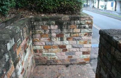
In 1825 a wooden wharf, known as Kings Wharf (later renamed Queens Wharf), was constructed together with the barracks and cottages of the Moreton Bay penal settlement high on the north bank of the Brisbane River. The wharf was the only entry to the settlement. A steep path from the wharf followed the alignment of what is now Queen's Wharf Road. Pedestrian access to the settlement was via what is now Miller Park. The current retaining walls are of various ages and are principally associated with the development of the river bank.
History:
The first wharf, constructed entirely of timber in 1825, featured a gantry. Most supplies and travel arrived and left from the old Queen's Wharf. Besides barracks and cottages, the most prominent building in the vicinity of the King's Wharf was the Commissariat Stores.
In 1842 Thomas Dowse arrived at the, by then, dilapidated wharf and purchased an allotment adjoining the wharf where he constructed the Victoria Wharf and Stores and later an Inn named the Queen's Head. Nearby was the Ship Inn the property of the well-known Patrick Mayne in the 1860s.
During a flood in 1864 its foundations gave way and the walls collapsed removing all
- Type:
- Landmark


